Jennifer Jewell – Selling Real Estate in Orangeville, Mono, Shelburne, Caledon, Alliston and area
Real Estate Serving Orangeville, Caledon, Mono, Alliston, Shelburne, Mulmur, Dundalk, Amaranth, What's my house worth evaluation
Jennifer Jewell – Selling Real Estate in Orangeville, Mono, Shelburne, Caledon, Alliston and area
Real Estate Serving Orangeville, Caledon, Mono, Alliston, Shelburne, Mulmur, Dundalk, Amaranth, What's my house worth evaluation
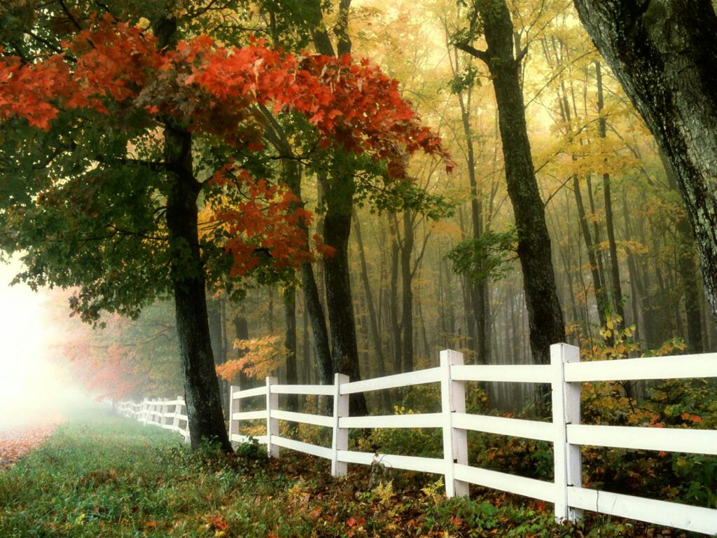
Property boundaries define the exact extent of your land and your legal rights as a property owner. In Orangeville, Caledon, and Shelburne, understanding these lines prevents disputes with neighbors and ensures you can legally complete future projects like fences, sheds, or additions.
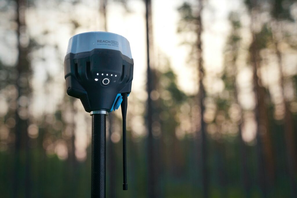
The most reliable document for determining boundaries is a Surveyor’s Real Property Report (SRP). This map, prepared by a licensed Ontario Land Surveyor, shows the property’s dimensions and the location of all structures relative to the boundary lines. While many sellers provide an existing survey, older documents may not reflect recent changes, such as a new deck or a neighbor's relocated fence. If an up-to-date survey does not exist, you can commission a new one to confirm your lot’s exact size.
You must also check for easements and encroachments. An easement grants a third party, such as a utility company or the municipality, the right to use a specific portion of your land. An encroachment occurs when a structure, like a driveway or a retaining wall, crosses the property line from a neighboring lot. These issues can complicate your ability to build or sell the home later.
Fences do not always align with legal property lines. Do not rely on old fence rows or tree lines as definitive markers. Before you start any construction, review your land title and consult the local building department to ensure you meet the required "setback" distances from your boundaries.

Jennifer Jewell, a licensed real estate
representative serving Caledon, Orangeville,
Amaranth, Alliston, Dundalk, Erin, Grand Valley,
Honeywood, Mansfield, Melancthon, Mono,
Mulmur, New Tecumseth and Shelburne.
Information provided for general purposes only and should not be relied upon as a substitute for professional advice.

Your information is being processed.